Published
|Last updated
Google street view
Learn what a popular - google street view - the phrase means in online marketing. Click and read more.
Published
|Last updated
Learn what a popular - google street view - the phrase means in online marketing. Click and read more.
![What is google street view - [Marketing Dictionary]](/assets/img/dictionary-background.webp)
What is google street view
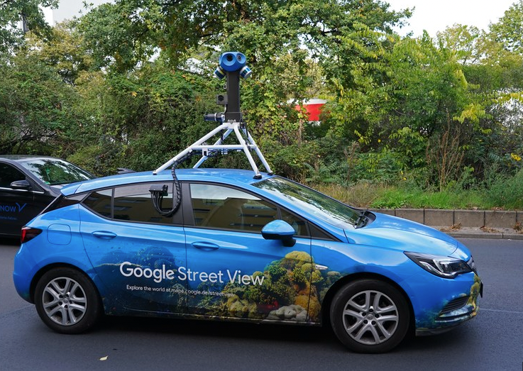
Google Street View is a technology featured in Google Maps and Google Earth that provides 360-degree panoramic street-level views of various places around the world. Street View imagery is captured by specially equipped vehicles, known as Google Street View cars, which are equipped with cameras and GPS technology. The imagery is then stitched together and made available to users on Google Maps and Google Earth.

To access Google SV users can go to Google Maps and type in an address or location. If view is available, users can click on the image of a street to enter view mode. This view can also be accessed through the Google Earth app, as well as through the Street View app, available on iOS and Android. Drag and drop pegman on the blue lines - it is the most common way.
Once in Street View mode, users can explore the surroundings by clicking and dragging the image to view different areas. Users can also zoom in and out, change their perspective, and move along the street using arrows or a compass. This can be used for a variety of purposes, including exploring a new city, planning a route, or previewing a location before visiting it in person.
While Google Street View has been praised for providing users with a convenient and immersive way to explore the world, it has also been met with criticism and controversy. Privacy concerns have been raised due to the fact that Street View images can capture views of people, faces, and license plates, which can be considered a violation of privacy. Google has responded by blurring faces and license plates in the images and allowing users to report any content they believe is inappropriate. However, controversies surrounding app continue to arise, such as accusations of trespassing and legal action taken against Google in some countries.
❤️ Spread the word! ❤️
Found this guide valuable? Share it with your colleagues to help them boost their local marketing results too!
Powered by Localo 2026